I-GUIDE banner featuring a topographic map background that transitions from teal to orange and white, displaying textured terrain.

Institute for Geospatial Understanding through an Integrative Discovery Environment (I-GUIDE)

I-GUIDE Logo

“Map, Connect, Discover”

About

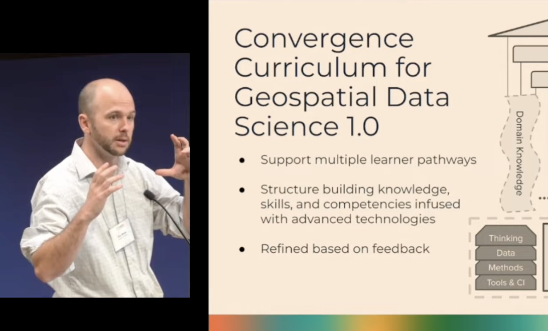
I-GUIDE harnesses geospatial data and AI to illuminate complex interactions across socioeconomic and environmental systems, advancing knowledge frontiers from emergency management to community resilience. The institute fosters multidisciplinary collaboration among academic, government, and industry partners, generating insights that inform real-world geospatial decisions essential to national economic development and security. I-GUIDE supports research in critical areas such as disaster resilience, aging dam infrastructure, and food and water security. Its findings are translated into digital knowledge elements on the open-access I-GUIDE Platform (https://platform.i-guide.io), supporting a wide range of research and educational activities for broad audiences.

Group photo of I-GUIDE team of about sixty people, all wearing I-GUIDE branded shirts, in a room with two white projectors.
A presenter in a dark green suit speaks into a microphone at a podium during a conference in a wood-paneled hall.
Six people work on laptops around a large conference table with a whiteboard in the background.
A large audience in a big hall watches a researcher present a slideshow on a projector screen.

Mission

"Advance convergence and geospatial sciences for holistic sustainability solutions"

A group of six applauds a man in a leaf lei below a screen titled "Team 3: Geospatial Simulation of Fire Ecology with Deep Earth."
Attendees stand in a conference hall, discussing scientific posters that feature colorful maps and data charts.
A presenter gestures, with presentation slides on the right, titled "Convergence Curriculum for Geospatial Data Science 1.0".

Vision

"Drive digital discovery and innovation by harnessing the geospatial data revolution"

Areas of work

A dark and light blue line icon of a globe with three location pins. The pins are placed over different land areas on the world map.

Geospatial Data

A dark and light blue line icon of a water dam. Streams of water flow down from the top into wavy lines.

Aging Dams

A dark and light blue line icon of an open hand holding a shield. Inside the shield is a simple drawing of a fork and a spoon.

Food & Water Security

A dark and light blue line icon of a circle split into four parts. It shows a tornado, a rain cloud, a cracked road, and a fire.

Extreme Events & Disaster Resilience

Principal Investigators

View full team External link icon
Headshot of Shaowen Wang, a smiling man with short dark hair, wearing a grey blazer over a blue polo shirt against a light grey background.

Shaowen Wang

Principal Investigator

Headshot of Carol Song, a smiling woman with wavy dark hair and bangs, wearing a cream-colored blazer over a black top.

Carol Song

Co-PI

Headshot of David Tarboton, a smiling man with short brown hair, wearing a dark blazer and light blue collared shirt.

David Tarboton

Co-PI

Headshot of Deanna Hence, a smiling woman with tight curly dark hair and glasses, wearing a black top and gold earrings in an office setting.

Deanna Hence

Co-PI

Headshot of Mohan Ramamurthy, a man with glasses and a mustache, wearing a magenta sweater over a brown collared shirt.

Mohan Ramaburthy

Co-PI

Publications

Explore in new tab

Stay Connected